![]() Coordinate
GIS
Coordinate
GIS
 |
|
| HOME | SCROLL DOWN |
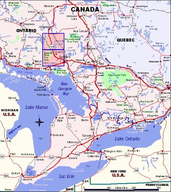
| Region of Ontario Covered by Map | |
| Purchase Maps GIS Services Contact Us Next Map » 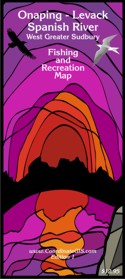 |
 |
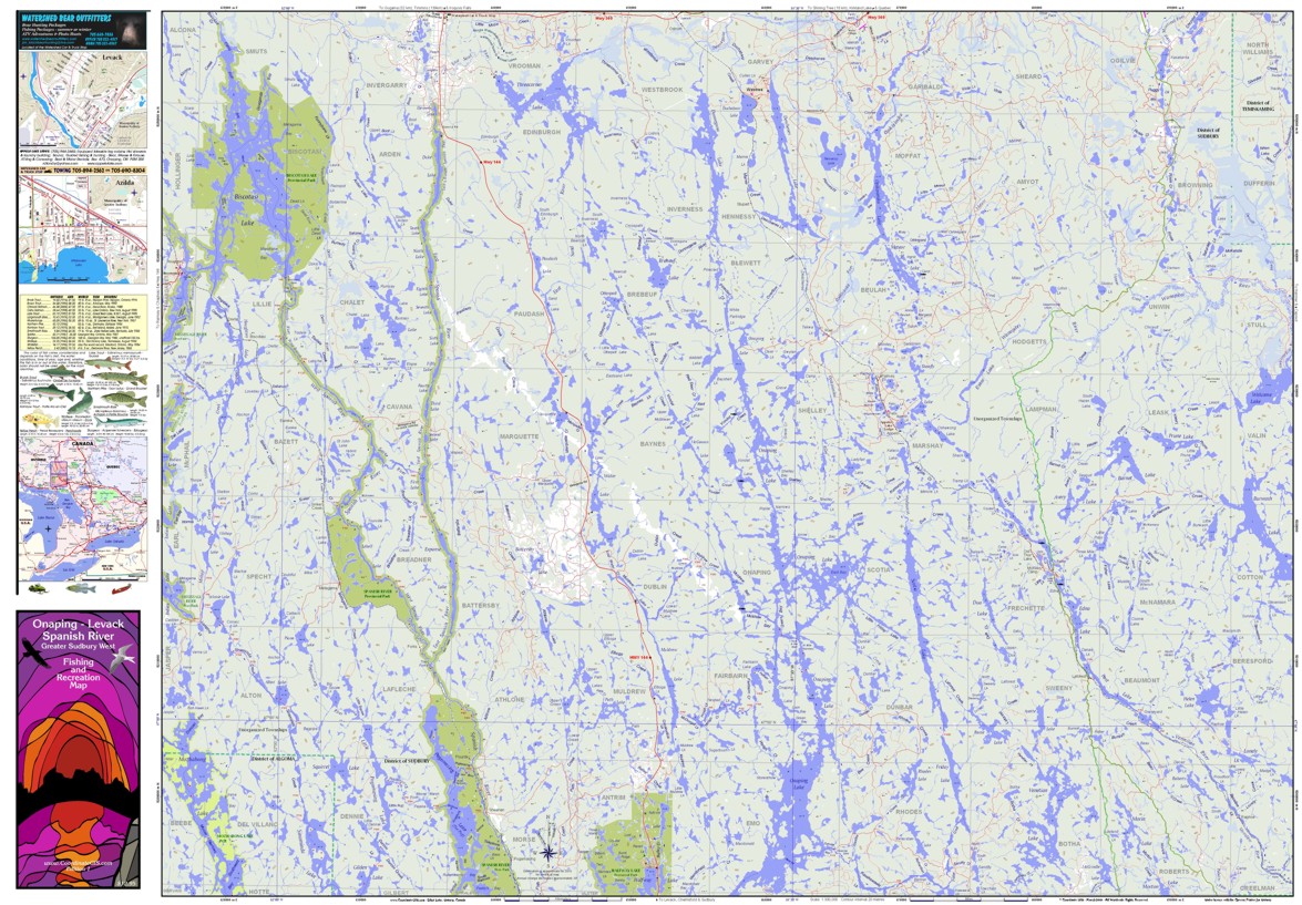
| Onaping - Levack - Spanish River - Greater Sudbury West - Fishing & Recreation Map 28 x 40 inches (contours are not shown here) - This simplified picture of both sides of the map. Scroll below and you will see the legend and the items that are shown on the map. Included in the sidebars are town maps of Azilda, Chemlsford, Levack and Lively. Showing Below: Biscotasing Lake, Three Corner Lake, Onaping Lake, Pogomasing Lake, Scotia Lake, Venetian Lake, Thor Lake, Opikinimika Lake, Donnegana Lake, and many others. Hwy 144 runs north to the Artic watershed. The towns of Westree and Biscotasing are to the east and west respectively. |
|
 |
|
|
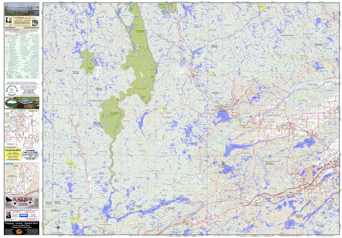
Showing Below: Agnew Lake, Birch Lake, Bigwood Lake, Fairbank Lake, Fox Lake, Kennedy Lake, Long Lake, Ministic Lake, Round Lake, Savage Lake, Sinaminda Lake, Vermillion Lake, Whitewater Lake, Windy Lake, As well as the towns of Azilda, Cartier, Chemlsford, Copper Cliff, Levack, Lively, Mikkola, Nairn Centre, Naughton, Whitefish. The dark green delineates the Spanish River, Rushbrook and Halfway Lake Provincial Parks. Yellow areas are Provincial Conservation Reserves. |
|
 |
|
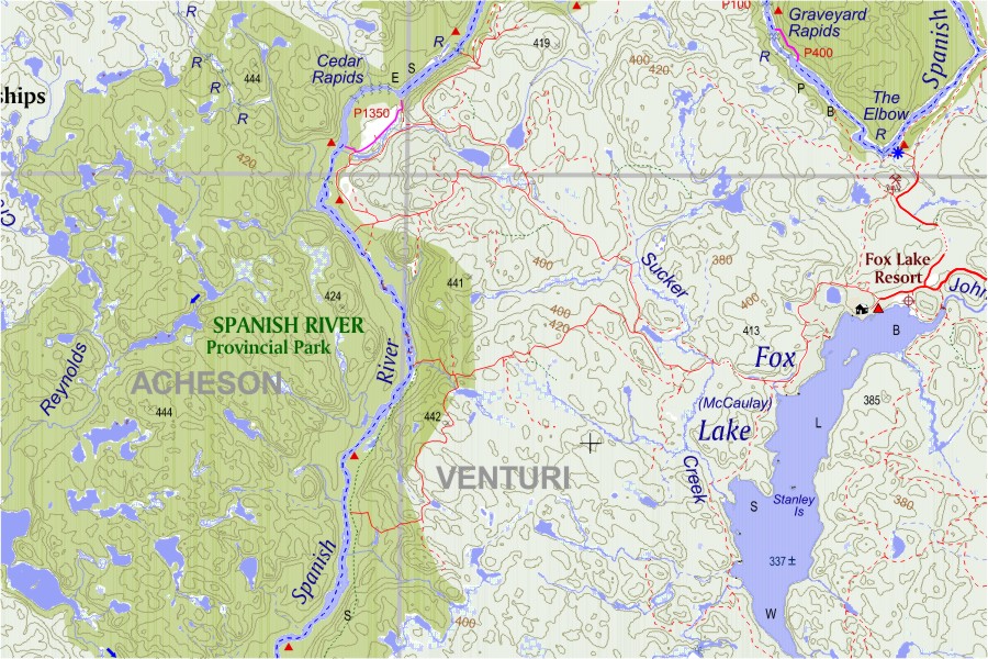
| Map Detail of Fox Lake and part of the Spanish River showong
townships, contours, Provincial Park campsites, garbage dump, spot elevationl, rapids, canoe route & portages, roads, rivers and wetlands. |
|
 |
|
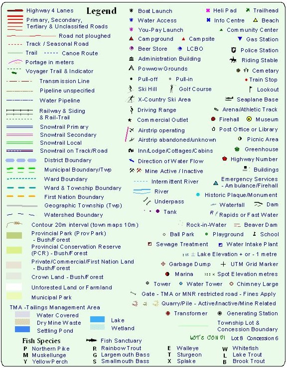
| Legend Items | |
 |
|
| HOME Contact us at: info@CoordinateGIS.com | |
|
Find us here via www.CoordinateGIS.com or via www.theMapLady.ca
|
|
|
|