 Coordinate
GIS
Coordinate
GIS
Geographic
Information Systems, Data
Analysis & Display, Global Positioning Systems, Mapping
& Consultations
![]()
|
|
|
|
|
|
GIS Services |
|
|
|
||
|
The |
||
|
Canadian
Nuclear Safety Commission |
||
|
Geographic
Information System |
||
|
|
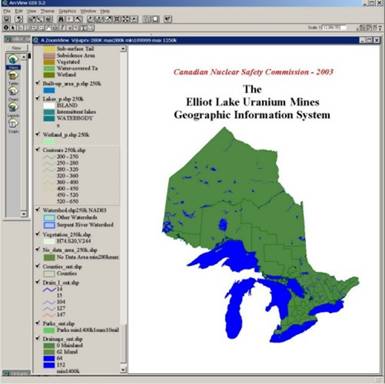
The CNSC Elliot Lake Uranium Mines GIS is a spatial database application composed of a collection of digital mine site and regional map layers, which were created and compiled for the Canadian Nuclear Safety Commission, as a powerful aid to tracking, viewing and analyzing their site data. The application functions within ESRI’s GIS software package ArcView 3.2. The mine site and sampling location information is based on GIS data developed between 1995 and 2002 for Rio Algom Ltd., now BHP Billiton. This information has been incorporated to fit within the 1:20,000 scale Ontario Base Map (OBM) data, distributed by the Ontario Ministry of Natural Resources. Regional maps are amalgamations of federal digital map sheets at both 1:50,000 and 1:250,000 scale. For ease of use the original 700 individual map layers have been reduced to approximately 115 layers at four different scales. |
|
|
Opening View – |
||
|
|
||
|
|
|
|
|
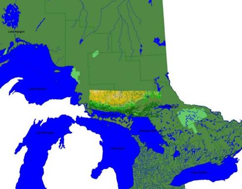
Contour lines (at 250,000 scale) for the area of interest, the North Shore of Lake Huron, Ontario, and park boundaries now activated. |
||
|
|
||
|
|
|
|
|
|
|
|
|
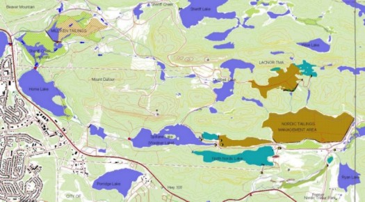
Zoom-in further and details at 1:20,000 scale
appear. Shown here is the eastern side of the City of |
||
|
|
||
|
|
|
|
|
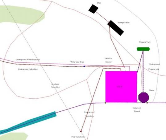
Zoom-in to greatest detail – The Nordic effluent treatment plant (ETP) showing utilities and water sampling locations. Lime is added to neutralize the outgoing tailings drainage water,. |
||
|
|
||
|
|
|
|
|
|
Contact: info@CoordinateGIS.com |
|